Monday, April 9, 2012

Pancake Rocks

This post is for Our World Tuesday

Trip Part 14 - Final!

Our trip up the west coast of New Zealand was aimed at seeing the Pancake Rocks at Punakaiki. We remembered this area very well from our trip here when we were children and the main difference seemed to be lots more tourists viewing the area and lots more barriers to stop people from foolishly getting too close to danger at the edge of the rocks.
The Pancake Rocks have been formed by erosion between hard and softer layers of rocks. The result is spectacular.
The rock formations have been upthrust from under the sea and the force of the sea is obviously still eroding the whole area. There are deep channels between and also under some of the rock stacks.

This photo was taken from the walking track out to the Pancake Rocks and looking south.
From here we turned south again to go back towards Greymouth and then the next day to travel back to Christchurch and then back home again. We stayed at the Beachview Motel just north of Greymouth at the little town of Rapahoe. The motel was very comfortable...
...with the most spectacular view right out the front door of the motel to the beach just a few meters away. We went to sleep that night hearing the sound of the surf - a perfect ending to our west coast trip.
The only thing left to show is one beautiful little bird. Tomorrow!

Saturday, April 7, 2012

West Coast

This post is for the Camera Critters Meme

Trip Part 13

Scenery and a day like this make New Zealand picture postcard perfect! Green paddocks/fields, cattle lying down resting, the sea in the distance, and bright blue sky and sunshine. What could be nicer?
The coast line north of the city of Greymouth was beautiful but it was not a place where I would want to swim. Rocky headlands alternated with stretches of beach. The sea was quite rough and the land looked as if it fell off quickly into deep water.

Wednesday, April 4, 2012

Weka

This post is for World Bird Wednesday.

Trip Part 12

Weka are one of New Zealand's flightless birds. Weka Gallirallus australis) are part of the Rail family and are sometimes known as Woodhen. There are four sub-species and considerable variation of color. They are about the size of a domestic hen. Like other flightless birds in New Zealand they are under threat from introduced animals/pests such as cats, dogs, rats, ferrets, and stoats.
We saw these two on the road just around from Punakaiki on the West Coast (more about this place in the next post). They were completely focused on each other and seemed completely oblivious of the traffic.

Tuesday, April 3, 2012

Glaciers

This post is for Our World Tuesday

Trip Part 11

The glaciers on the West Coast of the South Island of New Zealand are spectacular. They descend through very steep valleys down into lush temperate rain forest which is only 200-300 meters above sea level. Because they are in latitude 40's there are constant strong westerly winds and associated heavy rainfall. This makes an extra heavy snow pack up in the mountains and the glaciers move faster than is usual for glaciers. (Wikipedia says 10 times as fast!)
We stayed close to the little township of Fox so visited the Fox Glacier first. Both the Fox Glacier and the Franz Josef Glacier have retreated up their valleys for some years so there is quite a walk to get close to them. The walk at the Fox Glacier is advertised as 45 minutes - but it felt like much more! The track is clearly marked and starts off across the flats near the stream which flows out from the glacier.
Then the track winds up the hill above the glacier and finally comes quite close to the icefall at the end of the glacier.
There are barriers well away from the icefall and tourists are cautioned to stay back behind the barriers. In 2009 two people went around the barriers and close to the icefall. Tragically there was a huge fall of ice as they were standing there and they were both killed. I had the long lens on the camera to take both these photos.
The icefall
The head of the glacier (or at least the head visible from the bottom!) as it begins to descend very steeply.
Finally, of course, there is the walk back to the car park! Click on the photo to enlarge it to see the people walking along the track.
We went the 25 kms north to see the Franz Joseph Glacier in the afternoon. This was some of the steepest and windiest main road I have ever seen. One road sign warned of a corner that required a speed of 15 kms!
Since I had walked to Lake Matheson early in the morning and then up to the Fox Glacier I decided that I would only walk to where I got good views of the Franz Josef glacier. Again, there was quite a long walk across the boulders and gravel previously dropped by the glacier.
I showed photos of Mount Cook when we visited that area on day two of our trip. Here on the West Coast Mount Cook was clearly visible again through a gap in the mountains. This was the view from a little way down a road west of the Fox township.
Extra: If you have had enough of glaciers don't bother reading further! This is History! My sister and I were disappointed in Franz Josef Glacier because it was very different from what we remembered. We expected some changes of course but not such great ones. We remembered a beautiful little church with an altar window that had looked out on the glacier. By the time we traveled there the glacier had receded out of sight but there was still a view up the valley into the surrounding forest. The church is still there but is so far away from the glacier now that it is not even kept open! Then we remembered the walking track going down the same side of the valley beside a stream which had blocks of ice rolling along in it. At one place beside the stream there was a natural hot thermal pool surrounded by rocks. We joined some other tourists there and Mum and the Aunts sat with their feet in the hot water while we played with the ice in the stream and then carried blocks of it to surround the pool. None of this was there now! In fact, no one even remembered the hot pool! But I hadn't just dreamed it all. Dad had taken photos! Finally I found a young lady in the visitor's center who looked up history and dates for me and we found that first there had been a huge rock fall which totally changed this side of the valley. Then a few years later there had been a huge outbreak flood from the glacier which changed the valley again. Nothing stays the same!
Dad's photos!

Sunday, April 1, 2012

Road Users?

This post is for the Camera Critters Meme.

Trip Part 10
These photos were taken out the front of the car as we were traveling along in south New Zealand. Well, actually, we were waiting to travel again! This is a herd of dairy cattle that have just been milked in the sheds on the other side of the road and are now being moved to a paddock (field?) opposite. The farmer had a couple of very smart dogs to help him and when the herd got along the road to where the next gate was open there was another car stopped and (I assume) the farmer's wife holding out her arms to keep the cattle moving in the right direction through the gate. The cattle looked as if they knew where they should be going! Movement of cattle like this is often done morning and night across the roads. It was a common sight when I was growing up in NZ but I haven't seen it for many years.


Wednesday, March 28, 2012

Fantail

This post is for World Bird Wednesday

Trip Part 9

Much of the West Coast of New Zealand that we saw was wild and rugged with cliffs going down to the sea.
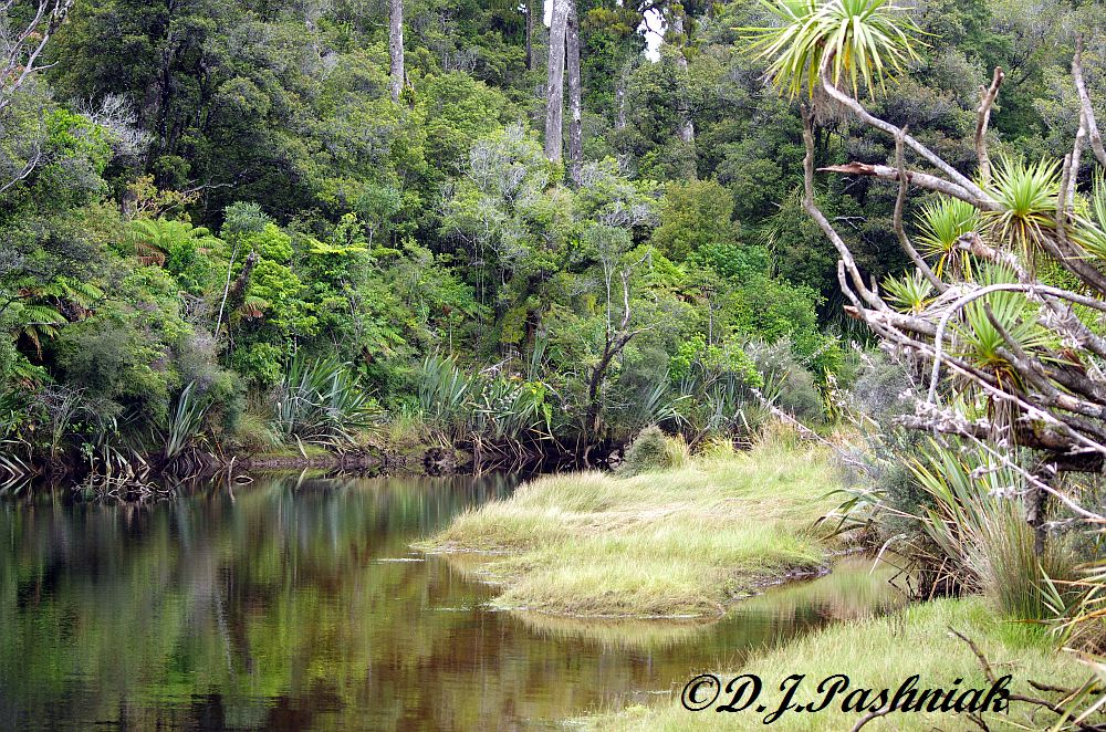
There were also places like this, where a little stream came out making a small lagoon behind the sand. The tall plumed grasses we called Toe toe when we were children, but there is also a similar plant - Pampas - which has been brought in from overseas and has become a pest.
Upstream there was a track around the wetland.
Birds called all around but the only one I got good views of was this New Zealand Fantail. It's Maori name is Piwakawaka.

Monday, March 26, 2012

Haast Pass

This post is for Our World Tuesday

Trip Part 8

The trip from Wanaka through the Haast Pass to the west coast was like nothing else we had seen thus far. First the road gradually traveled up a valley until we were high enough to be in forest country again. This was true rain forest and there were numbers of marked tracks and interesting sights along the road. Each was well sign-posted so if you didn't want to see everything it was easy to pick what you did want to do. We walked into the rain forest down a well-made track. This looked and smelt like the forests we knew when we were children growing up in New Zealand. We loved the moss and ferns on the ground and hanging off everything.
As the road started to descend on the other side of the Pass we came out into a little valley with a stream down the middle. There was a picnic area and camp ground here. In the foreground of this photo is a row of New Zealand Flax plants. This is quite a different plant from the flax of the northern hemisphere but because of its fibrous leaves it was given a similar name.
From here on the road got steeper and more windy. When we toured the south island of New Zealand with our parents all those years ago we remembered that Dad did not want to travel over this pass so we went further north and went over Arthur's Pass. Driving this road this time we did wonder why - but then read one of the tourist notices that said this pass was only officially opened in 1960. It was Christmas of that year that we had been here. I am sure that the road would not have been sealed back then (very little was!) and it must have been pretty hazardous after rain! Even now the only bridges were all one way and there were notices with arrows showing which direction had right of way. All the notices said that heavy traffic had to slow down to 20 km (just over 12mph).
This bridge is at a place called the "Gates of Haast".
Even when we got down to sea level most of the bridges were still one way only. One of the longest ones over a wide shingle river even had a passing place in the middle of the bridge.
More about the west coast next time.